In Turkey's Amuq
Valley researchers from the Oriental Institute focus on
big-picture patterns of the ancient world.
It was September in the Amuq Valley,
and the cotton was bursting its husks. On both sides of
the road stretched a sea of green flecked with white. Riding
north in a big Ford van, Jesse Casana, AM'00, stared out
the window, ignoring his colleagues' chatter. Whenever he
traveled in the Amuq, he seemed to lose himself in the landscape.
Sometimes he leaned his head out the window, like a dog
muzzling the wind, to get a closer look.
He was not admiring the scenery. He was
studying it, sizing it up, looking for clues to its past.
He was doing archaeology on the fly. Casana is a Ph.D. student
in Chicago's Department of Near Eastern Languages &
Civilizations and a researcher at the Oriental Institute
(OI). Usually his fieldwork was more systematic. He and
his colleagues tramped along a predetermined course, scrambling
up hillsides, cutting through olive groves, scanning the
ground for the residue of ancient civilizations. But even
from a passing car, a few scattered stones or broken roof
tiles glimpsed in a field might reveal the site of an ancient
village or hamlet. "There is so much out there,"
Casana explained, "a lot of our finds end up being
opportunistic."
 |
|
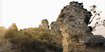
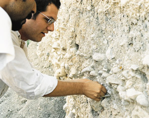
Chicago
researcher Jesse Casana (right) and his Turkish colleague
Merih Erek stand above the Amuq.
|
There are two kinds of archaeology. One
is the work of pick and shovel, wheelbarrow and trowel.
It is expensive and time-consuming. Excavating an ancient
town or city requires dozens of workers to haul and sift.
It commits the young archaeologist to weeks of toil in a
hole ten meters by ten. It is what most people think of
as archaeology: Heinrich Schliemann exhuming the burnt layers
of Troy, Indiana Jones saving the Lost Ark. But some archaeologists
find it, well, limiting. Instead of pouring their energies
into one spot, they study the whole landscape, ranging widely,
by foot and motor; increasingly they gaze down from above
with the help of aerial and satellite photography. They
are searching for deeper landscapes, and the land is a palimpsest
that they read for the long-ago stories that humans have
written and rewritten into it. They look for broad settlement
patterns—not just the cities, but smaller communities
and farmsteads, as well as the roads, canals, river channels,
and fields that lay between. They investigate the forces
that shaped the landscape, including erosion, deforestation,
and the expansion and contraction of agriculture.
Even to an experienced eye, the endless
rows of cotton revealed little. But Casana had a trick in
his field bag. As Hanifi Topal, his cheerful Turkish driver,
headed north, Casana switched on his Global Positioning
System (GPS)—an instrument about twice the size of
a cell phone that could fix his position to within about
ten meters-and thrust it out the window. Back in Chicago
he had pored over black-and-white satellite photos from
the U.S. Geological Survey. The photos, taken by American
spy satellites in the 1960s and 1970s, reveal blemishes—archaeological
sites—on the valley's surface. From space even very
small sites show up as variations of light and shadow or
a slight discoloring of the soil. Site No. 290, on the photos
a dark circle about 150 meters across, lay invisible under
the cotton, but Casana was homing in on its coordinates.
"We're about a kilometer away," he announced.
The van crossed an irrigation canal, stopped, and everyone
piled out.
Casana's team that day included three
American graduate students, a Turkish professor of archaeology,
and a Turkish undergraduate. Casana had gathered them for
their diverse interests and expertise: one knew the Paleolithic,
another ancient Rome, still another the later Islamic period.
Following the GPS like a divining rod, Casana led them through
a ditch and across a bare field toward the cotton's edge.
He wore a floppy brimmed white hat, a long-sleeved white
shirt, and loose khaki trousers. The heavy Amuq clay clung
to his hiking boots. The GPS told the archaeologists they
were 160 meters away. When at last they waded into the cotton,
they found the ground littered with broken pottery. Casana
stooped and quickly gathered a few pieces, piling them in
a cupped hand. "This might be an early site,"
he exclaimed. Some sherds were dusky, others pale with daubs
of orange or black paint. "Look at this," he said,
holding out a gray, gently curved piece. "This is great.
It's Chalcolithic pottery of the oldest period of occupation-6500
to 4500 B.C." It was rare to find a site this old on
the Amuq, he said. Most lie buried beneath too many feet
of sediment or at the bottom of mounds built up by later
civilizations. He crouched in the cotton and picked through
the scraps, cast up from the dawn of human history on the
Amuq. He was deep into the landscape and loving every minute.
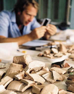 |
| Bryn Mawr grad
student Andrea DeGiorgi records sherds from Amuq sites. |
The Amuq
Valley lies in southern Turkey at the upper right-hand
corner of the Mediterranean Sea. It is a small patch of
the Fertile Crescent, the great arc through the Middle East
where agriculture and cities first appeared. To the east,
just over a range of hills, lies the upper Euphrates. The
Amuq is actually more plain than valley, a 30-mile-wide
expanse of cotton and wheat fields, irrigation ditches,
and scattered villages, bounded on three sides by hills
and mountains. The Orontes River loops through it, flowing
from its Syrian headwaters to the Mediterranean, but the
Orontes did not carve the valley. The Amuq is a rift valley,
formed by the same seismic shifts that opened up the Jordan
Valley and the Great Rift Valley of East Africa. Amuq, an
old name, comes from an Arabic word meaning deep.
(In Turkish the valley is usually called Amik Ovasi—ovasi
is Turkish for valley.)
Breaking the monotony of the plain are
many small, isolated hills. These are not natural features
but the sites of ancient towns and military fortresses,
built up slowly over hundreds and thousands of years. Some
are low enough to be cultivated by local farmers; others
jut 50 or 100 feet high. Not all are abandoned. In a few
places Turkish peasants live in concrete-block houses on
the buried ruins of Bronze Age towns. From almost anywhere
on the Amuq a dozen or more mounds are visible.
Blessed with rich soil, plenty of water,
and a mild climate, the Amuq has been prime real estate
since the beginning of agriculture. Humans have lived here
for perhaps 100,000 to 200,000 years, and it has been densely
inhabited for at least the past 8,000 years. In and around
the valley archaeologists have found the relics of Paleolithic
hunter-gatherers, Neolithic villages, Bronze Age kingdoms,
and outposts of the Roman Empire. At the plain's southeastern
corner, where the Orontes flows beneath a steep mountain
ridge, stood the ancient city of Antioch. Today it is called
Antakya and is the bustling capital of Turkey's Hatay province.
But until an earthquake destroyed the city in 526 A.D.,
Antioch was the greatest city of the Roman East. Its archaeological
museum has one of the world's finest collections of mosaics,
dug up from Roman palaces that still lie buried beneath
the modern city.
Among archaeologists the Amuq lacks the
allure of Mesopotamia, which lies hundreds of miles to the
southeast and is known as the heartland of cities. But it
has nonetheless attracted its share of attention. Between
1937 and 1949 the great British archaeologist Sir Leonard
Woolley excavated Tell Atchana, the capital of a small Bronze
Age kingdom. Woolley was drawn to the Amuq because it lay
at an ancient crossroads. To the north were the Hittites;
to the east, Babylon; to the south, Palestine and Egypt;
to the west, over the Beylan Pass, the Mediterranean and
the whole Greek world. "From the point of view of commerce,"
Woolley wrote in A Forgotten Kingdom (1953), the
Amuq was "the meeting-place of the Great Powers."
Chicago also sent teams to the Amuq.
Between 1932 and 1938 Robert Braidwood, PhD'43, the late
director emeritus of the Oriental Institute, explored the
valley, finding 178 archaeological sites and digging at
eight. But the gathering storm of World War II forced Braidwood
to abandon the Amuq. Woolley returned briefly after the
war but left for good in 1949. For decades no archaeologist
worked in the Amuq, in part because the political climate
had changed. In the 1930s the region was a Syrian province
administered by the French. After the war it became part
of Turkey, and Turkish officials steered archaeologists
farther east, where new dams on the upper Tigris and Euphrates
Rivers—part of an ambitious irrigation project—threatened
archaeological sites. "The Amuq Valley and Antioch
were put on the back burner, and nothing was done,"
said K. Aslihan Yener, a Turkish archaeologist and associate
professor at the Oriental Institute. "That entire region
fell asleep."
 |
| Some sites,
like the village of Terzihöyük, or Tell Terzi,
are still inhabited. |
The region returned to the front burner
in 1995, when the OI started its Amuq Valley Regional Project.
Directed by Yener, the project revived, and enlarged, the
OI's interest in the Amuq. Working elsewhere in Turkey Yener
had developed an expertise in ancient mining and metallurgy.
The Amuq offered an opportunity to expand her studies to
fresh territory. She wanted to see, among other things,
what happened to the metals she had seen mined farther north
when they reached their markets. But the project was envisioned
as an ongoing effort that would encompass a range of archaeological
investigation. In addition to excavating some of the valley's
most important mounds—and revisiting Tell Atchana,
the Bronze-Age mound that Woolley excavated—archaeologists
would study the landscape to a degree that went far beyond
Braidwood's early survey. This part of the project fell
to Tony Wilkinson, another associate professor in the OI
and one of a rising generation of landscape archaeologists.
Born in England and trained in Canada
as a geomorphologist, Wilkinson has studied ancient landscapes
in Iraq, Syria, Turkey, and Yemen, where aerial photographs
helped him discover a Bronze Age civilization that no one
suspected could have existed so far south on the Arabian
Peninsula. In the Amuq Wilkinson is interested in long-term
changes in population and settlement. For him one important
story is the coalescing of settlement in the Bronze Age,
when centralized kingdoms emerged and people began living
exclusively in large fortified towns. He is also interested
in seeing how the Amuq changed as the valley came under
the sway of the great ancient empires, including the Assyrian
and the Roman. "We're looking at settlement changes,
changes in the ecological environment, changes in transport,
and how they all relate," he said.
At 53 Wilkinson is white-haired, energetic,
and given to expressions like "Right! Brilliant! Let's
go!" In fall 2002 he and two Chicago colleagues began
a project in Iran, which had barred Western archaeologists
since the Shah's fall in 1979, and in many ways he seems
to fit the Indiana Jones image of the intrepid archaeologist-adventurer.
In fact he is a pioneer of a kind of archaeology that has
become suddenly fashionable. "It's basically ancient
geography," he explained. "Traditionally archaeologists
have looked at specific archaeological sites and what's
in them. That's a narrow perspective. Our perspective gives
a much wider range of information on changing economies,
and especially how different areas interact with each other,
in terms of transport, agricultural production, and mineral
production."
Landscape archaeology is not new. Even
Schliemann's 19th-century study of Troy included the Trojan
plain. But landscape archaeology did not emerge as a separate
discipline until the late 1940s, when Harvard's George Willey
mapped ancient settlements, canals, and field systems in
Peru's Biru Valley. Then, beginning in the late 1950s, Robert
McCormick Adams, PhB'47, AM'52, PhD'56, later director of
the Oriental Institute, undertook a series of landscape
studies in Iraq. Adams, who went on to become secretary
of the Smithsonian Institution and is today an adjunct professor
in anthropology at the University of California-San Diego,
used aerial photographs to study remnants of the ancient
Mesopotamian landscape. He was able to determine what the
land looked like before and after cities began to form—how
scattered settlements gave way to urban centers. "That
was so popular it led other people all over the world to
begin similar kinds of studies," said Curtis Runnels,
a landscape archaeologist at Boston University and editor
of the Journal of Field Archaeology.
 |
| Casana pulls
a Paleolithic stone tool from a layer of gravel. |
Casana, one of a half-dozen graduate
students who work with Wilkinson, is 27 years old and grew
up in Springfield, Virginia. "As a kid I was obsessed
with trying to find old stuff in parks or woods or wherever,"
he said. "I was always carting home boxes full of rocks
that I suspected might be stone tools, although I don't
think I ever found any. Sometimes I tried to make maps of
the places I went exploring. I always wanted to be an archaeologist.
Sometimes it was a paleontologist." During his first
season on the Amuq he took part in the excavation of an
older mound, Tell Kurdu. After that he began to work under
Wilkinson, gradually taking over much of the Amuq investigation.
The work has taken him over a lot of ground, sometimes by
car, more often on foot, in terrain that can be rugged and
steep but always full of surprises. "It's fast and
dirty and cheap," he told me over lunch one day in
Chicago. He was in the midst of planning his September fieldwork,
and he was brimming with enthusiasm. "We can go out
there and in a few weeks find stuff that challenges conventional
wisdom. We find a ton of things that people never knew existed."
I arrived in the Amuq in late August,
crossing over the Beylan Pass in a bus from Adana, a city
on the Mediterranean coast. The route was ancient but the
road was modern—a divided highway that wound down from
the pass to the flat green valley below. In the bus, which
was as sleek and modern as the highway, a young man wearing
a tie served Coke in plastic cups and squirted lemon-scented
lotion into the hands of the passengers. In Antakya I found
Casana and his colleagues living near the city center in
an aging four-story French colonial house, a few doors down
from the large buff-colored building that once housed the
French provincial administration and is today a pornographic
movie theater. Casana had rented the ground floor of the
house. It was cool and airy and cluttered with gear: cots
and sleeping bags, maps and satellite photos, reference
books, and plastic bags stuffed with broken pottery collected
the previous season.
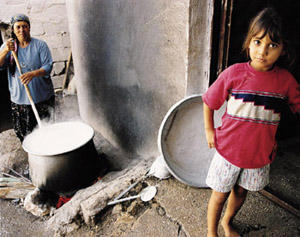
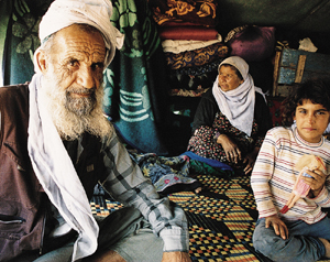 |
| While the grad
student reaps clues to the past, an Arab family has
come to the Amuq to pick cotton. |
In the Amuq old civilizations reveal
themselves principally through their ceramics. Where people
have lived for long periods of time, the ground is usually
littered with broken pottery—fragments of water pitchers,
plates, bowls, cups, goblets, cooking pots, and large storage
vessels called pithoi. As fashion and technology
changed over time, so did the pottery, and by studying this
ancient refuse, archaeologists can determine with remarkable
accuracy when a site was inhabited. And while newer layers
of settlement cover older ones, the old does not usually
stay covered. After thousands of years, bits work their
way to the surface. Worms, burrowing animals, wind and rain,
tree roots, plows—these are some of the instruments
that turn the soil and bring up what is buried. Without
lifting a shovel or a trowel, an archaeologist can simply
examine this surface litter and know a site's full range
of occupation.
The day I reached town, Casana and his
crew were getting impatient. He had arrived in mid-August
with ambitious plans for two months of fieldwork. In the
Middle East, fieldwork generally takes place in the autumn,
after the summer heat has passed, and usually lasts only
a few weeks. Casana had hoped to spend much of the field
season exploring the hills around the Amuq, looking for
the kind of small, dispersed settlements he and others had
already found in abundance on the plain. But archaeology
is politically charged and fraught with obstacles. Much
archaeological effort, it turns out, is expended in a perpetual
quest for permits and endless wrangling with officials.
Casana's permits had hung up somewhere
in the Turkish Interior Ministry—he didn't know where
or why. So instead of spending their days covering new ground,
Casana's team stayed in Antakya and recorded the previous
year's potsherds. It was dull but necessary work. They emptied
plastic bags, measured the contents with calipers and diameter
charts, and made careful sketches on pale blue graph paper.
To a trained eye, the sherds were more than fragments; a
small slice of a rim or crook of a handle might blossom
in the imagination into a whole bowl or drinking cup. Laid
out on a table, the fragments spanned 8,000 years of human
history and many ages of the Amuq: Chalcolithic, Early Bronze,
Middle and Late Bronze, Iron Age, Hellenistic and Roman,
Late Roman and Early Byzantine, Middle Islamic.
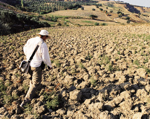 |
|
Casana trods
a freshly plowed field above the Amuq.
|
One morning Casana and his colleagues
left on an excursion that was part reconnaissance, part
tourism. They stopped at site No. 290, filling in that blank
spot on the map of the Amuq. "I like to find a new
site every day," Casana said. "Otherwise I feel
I'm not really working." They also visited Tell Atchana,
where Woolley's old dig house still stood, an abandoned
two-story timber-frame building. Some of the ruins Woolley
unearthed had been left uncovered: mud brick walls built
in the Bronze Age and Woolley's "Stratification Pit,"
dug down more than 50 feet to the layers at the bottom of
Tell Atchana. This coming autumn Tell Atchana will be bustling
again as a team led by Yener and OI associate professor
David Schloen resume excavations. A single guard stood watch.
Then an old man hobbled up to see who the visitors were.
He wore sandals, a red-and-white head wrap, and baggy charcoal-gray
trousers with the crotch at the knees, a style favored by
older Turkish men. Ali Yalçin introduced himself
as one of Woolley's workers from the 1940s. "I was
just a zambil," he said—a boy who hauled
dirt in a basket. He leaned on his walking stick and grinned
a broad, toothless smile. "It was good work."
The permit
arrived at last, thanks to the intervention of the
U.S. embassy in Ankara. The next day Casana and the others
drove out of Antakya by 6:30, just as the city began to
stir. On one street corner men with shovels gathered in
the hope of work as day laborers. A man pushed a cart of
round, pretzel-like breads along the street. The archaeologists
drove east, following a two-lane road along the base of
the low, brown hills bordering the plain. They stopped at
the mouth of a small valley where a low hill, Casana explained,
was the mound of an Iron Age city. "I want to get some
early material, which might be hard to find and might not
be here at all."
The students set to work, prowling the
hill for bits of pottery. Casana led Merih Erek, a professor
at Mustafa Kemal University in Antakya, down to a gully
where a stream had cut through deep layers of alluvial gravel,
exposing the stones of an old Roman dam or mill foundation
and a later wall. Such discoveries were crucial; they would
allow Casana to date the alluvium and the erosion that had
produced it. The two archaeologists scrambled to the gully's
bottom, stood before a cut bank about 20 feet high, and
scanned the layers of gravel. Toward the bottom of the ban,
Casana noticed a piece of flint, hard and shiny against
the dull gray limestone gravel. He wiggled it free. It was
a "lithic," an old stone tool. Sometime about
100,000 years ago, in the Middle Paleolithic era, a scalloped
edge had been chipped into it by some ancient Amuqian. Casana
looked more closely at the layer. He spotted more flints
and pried them loose. The gravel was thick with lithics,
washed down from somewhere above. "It's likely there's
a Paleolithic site up the valley," he said. "It
might be hard to find, but it's probably there." He
turned to his Turkish colleague, who dreamed of finding
a Paleolithic cave. None had yet been found in the Amuq.
"What do you think?" Casana asked. Erek grinned.
"I am a very happy man."
An hour later they were grinding up a
narrow road past the squat, concrete-block houses of local
farmers and up into the side valley. The hills were parched
and brown, in sharp contrast to the irrigated fields of
the Amuq below. It would be more than a month before the
autumn rains arrived. Even the steepest slopes were a patchwork
of olive groves and small fields with wheat stubble, scraggly
cotton, melons, and tobacco. The previous year, Casana and
Wilkinson had begun exploring these hills, looking for archaeological
sites. In such rough, uneven terrain satellite photos were
of little use; they work best on the plain, where only slight
differences in uniformity stood out clearly. In hill county,
archaeologists were forced to use an old-fashioned method—walking.
Casana and the others spread out at 100-meter intervals
and set off in a ragged line up the valley, scanning the
ground as they trudged along.
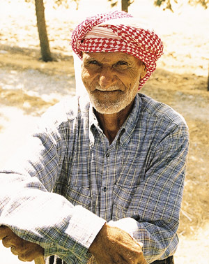 |
|
Ali Yaçin worked as a dig boy for British archaeologist
Sir Leonard Woolley in the 1940s.
|
"It's a lot more systematic than
it looks," Casana said. "What we're trying to
do is just to sample this area of the landscape to see if
there are any sites on it. The problem is we have to cover
all parts of a valley, so we know where sites are, but also
so we know where sites aren't." They were looking for
any scrap of a human artifact—a broken roof tile, a
potsherd, maybe even a flint scraper. No matter how small,
an archaeological site would show up as a patch of broken
pottery, surrounded by a more diffuse "halo" of
potsherds. "When you're near a site," Casana said,
"you know it."
The ground was uneven, the slopes steep.
The sun blazed down, and a dry, constant wind blew from
the west. Communication became difficult. They were spread
out too far, and the wind was too loud, for shouting. Casana
tried hand signals, but mostly he used his cell phone. Everyone
carried a phone; it was an essential piece of field gear.
He dialed Alexandra Witsell, a Chicago grad student about
200 meters away. "If you see one sherd, look for more,"
he told her. "If you see more, we may be on to something."
The wind carried sounds up from below.
Somewhere a rooster crowed. A sheep bleated, a child shouted.
Suddenly Casana stopped and bent down. "Here's a little
bit," he said. He walked a few feet. "Here's another
little bit." He tossed aside two small orange chunks
of badly worn pottery and gazed up the slope. "I feel
there's something up there, and we're just skirting the
edge of it." He climbed through rows of spindly cotton
to the edge of an olive grove. A piece of a broken roof
tile lay in the dirt; he kicked it with the toe of his boot.
"These kinds of things are a lot more immobile,"
he said. He spotted a thick, slightly curved chunk of pale
orange ceramic, probably the broken rim of a storage jar.
The archaeological museum in Antakya had many of these giant
pithoi—fat, deep, and bigger than refrigerators.
Casana stood for a moment, puzzled.
"These are the kinds of places I
hate," he said. There were too few potsherds to make
a site, but too many to ignore. "Wait," he said
at last. "Look here." Thirty feet away, on a patch
of bare ground, lay a few small building stones, broken
roof tiles, and little stone cubes of Roman flooring, called
tesserae. "Yes, here it is," Casana said,
relieved. The scattered potsherds extended into the olive
grove, and he walked quickly around the perimeter of what
seemed the densest patch. AS 291, as he named it in his
notebook, was not large. "It's probably a little thing,
a farmstead, 50 meters or so, but it's real," he said.
"It's about the bottom end of what you find. It was
probably just a few houses." He pulled a plastic bag
from his shoulder sack and began to collect samples. "This
is very typical of the sites we've been recording the past
five years." He picked up a thin, delicately curved
piece of orange pottery. "It's early Roman, probably
the first or second century A.D.," he said, slipping
it into the bag. Özlem Dogan, the Turkish student,
hiked up to help. After ten minutes, they poured their bags
out and selected samples to keep. These were the ones that
seemed the most diagnostic—pieces that could be pinned
to a specific period. "Good," Casana said as he
fingered the sherds. "Very good." He held up a
heavy chunk of a pot rim. "What's this?" he asked.
"Pretty ugly." It went into the keep pile. "We
have to be pretty aggressive about culling this stuff in
the field," he said. "Otherwise we end up with
massive amounts of material." Then he sat down in the
shade and jotted some notes. He took coordinates from his
GPS. His phone rang. Asa Eger, another Chicago student on
the team, had found a second site in an olive grove a little
way up the valley. They had already found two new sites,
and it was barely lunchtime. "It's been a good morning,"
Casana said.
They ate a meal of feta cheese and bread
in the shade of some olive trees, then continued their tramp
up the valley, finding several more sites, collecting more
potsherds, taking careful notes. The next day they returned
and surveyed some of the higher slopes, struggling up a
steep, windswept hillside that yielded nothing but a view.
The Amuq plain stretched below, the cotton shining bright
green in the morning light. "Our objective is to understand
the whole landscape," Casana said, standing with his
back to the wind. "We have to sample the whole area,
the steep rocky hillsides, the streambeds. We have to demonstrate
where there aren't sites. A lot of my colleagues don't like
this part." The wind boomed across the hills, shaking
the wheat stubble. "How do they even get a plow up
here?"
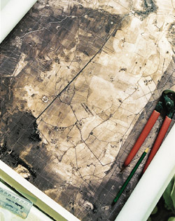 |
|
A Cold War satellite map shows ancient mounds in the
Amuq.
|
After surveying the first valley, they
moved on to others. It was exhausting work. Tramping over
the hills left them sore and weary. But they were finding
new sites every day. Some were the size of hamlets and villages;
others were, in Casana's words, "crappy little farmsteads."
Slowly, however, they were filling in the landscape's story—a
story of dramatic change. Until late in the first millennium
B.C., most people in the Amuq lived in a few large towns
and villages. Then they spread out, moving into smaller
and more dispersed settlements, into villages, hamlets,
and crappy little farmsteads. Casana and others had found
dispersed settlements on the plain itself. Now, exploring
the small valleys in the fringe of hills, they discovered
that the expansion had been upwards as well. "Virtually
all the sites date to the first century A.D.," Casana
said. "By then, there's a huge population in these
villages." The settlements seem to have flourished
until the eighth or early ninth century. By the tenth or
11th, most were abandoned.
Another part of the story involved environmental
change. As people dispersed on the Amuq and moved into the
surrounding hills, there was an increase in erosion that
lasted for hundreds of years. But Casana couldn't yet say
why. Did farmers cause the erosion by cutting forests and
clearing new fields? Or did erosion increase when farmers
abandoned terraces on steep slopes? Many basic questions
eluded explanation. Why did settlement patterns change in
the first place? What compelled people who had lived for
millennia in large walled towns to spread out into villages,
hamlets, and farmsteads, and then to abandon them centuries
later?
"There are a lot of unknowns,"
Casana said one afternoon, pausing on a high slope. "We
have all these small sites. There are hundreds of years
of occupation. It's hard to know what's going on."
Later, over dinner in an Antakya restaurant, he explained,
"The more you look into these questions, the more you
realize you can't really answer them. Our knowledge and
our methods are just too crude."
It was a problem that had long troubled
him. "All archaeology is like that," he said another
time. "What we want to know are things about action
and belief in the past, and what we have are potsherds on
the ground. Even if you dig them up it's still just more
stuff, unless you have texts, and even then it is fraught
with problems. How to reconstruct action from object is
one of the old central problems of archaeology. I try in
my own work to ask questions that the data can answer, but
it's hard. I can address something like when did settlement
become dispersed into the hills, but I can't really do much
more than to speculate and argue about why."
I stayed
about a week on the Amuq. By the time I left the
cotton pickers had arrived in the valley. They were mostly
poor Kurds and Arabs from eastern Turkey. They pitched canvas
tents next to the fields and collected wheat chaff and old
cotton stalks to burn for cooking fires. Far off in the
fields whole families were already at work, specks of color
bobbing in the green. Preoccupied with reading the Amuq's
past, the archaeologists barely seemed to notice the present.
They would stay on for another fortnight. Wilkinson joined
them, and they worked harder than ever, going out in the
morning, returning for lunch and rest, then going out a
second time in the afternoon. There was, Casana said later,
"So much to do, so little time."
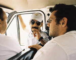 |
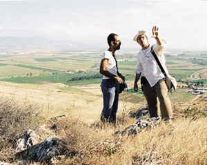
|
Going to a site
Casana and Erek (in cap) are, as always, accompanied
by a Turkish official.
|
And so much ground to cover. They returned
to site No. 290 and found, beneath the cotton, a rare agate
stamp used to imprint the clay seal of a jar or basket.
(The archaeological museum in Antakya later claimed it for
its collections.) They crossed the Amuq and explored the
slopes and valleys of the Amanus Mountains on the plain's
north side, discovering settlements no higher than 600 meters,
which happens to be the ecological limit of olive cultivation.
Perhaps, they speculated, the dispersal of settlement around
the Amuq had been caused by farmers seeking to expand olive
production. They discovered that a site near the Beylan
Pass was older than had been thought, confirming that the
pass had been part of an ancient trading route to the Mediterranean.
And they found a site in a hard-to-reach forested area that
may have been a summer resort for wealthy Romans fleeing
the hot summers of the plain.
Wilkinson left in the third week of September,
heading to Iran, and Casana and the others ended their fieldwork.
They had hoped to do more, but they no longer had permission
to keep working. In any case they were exhausted. "The
season was a great success," Casana said back on campus,
where he is spending the year writing up his dissertation.
"Everybody got along, and we got a lot done."
But his thoughts were already racing ahead to his return
and further explorations in the mountains on the plain's
north side. "We found fascinating things up there,
and there is a lot we don't know about them," he said.
How dense were the settlements in the high valleys? What
were people doing there, anyway? Were there mines, quarries,
and roads? He also wanted to look harder for a Paleolithic
site. He and his colleagues had found plenty of stone tools
on the Amuq; maybe they could also find a cave where the
makers had lived. Someday, too, he dreamed of doing a full
archaeological survey within the city of Antakya, looking
for ruins of ancient Antioch. The buried Roman city is thought
to be inaccessible, but just driving around he had already
found bits of it on Antakya's outskirts, where new construction
is exposing-and destroying-archaeological sites. The search
for ancient landscapes led in all sorts of directions, and
to many more seasons on the Amuq.